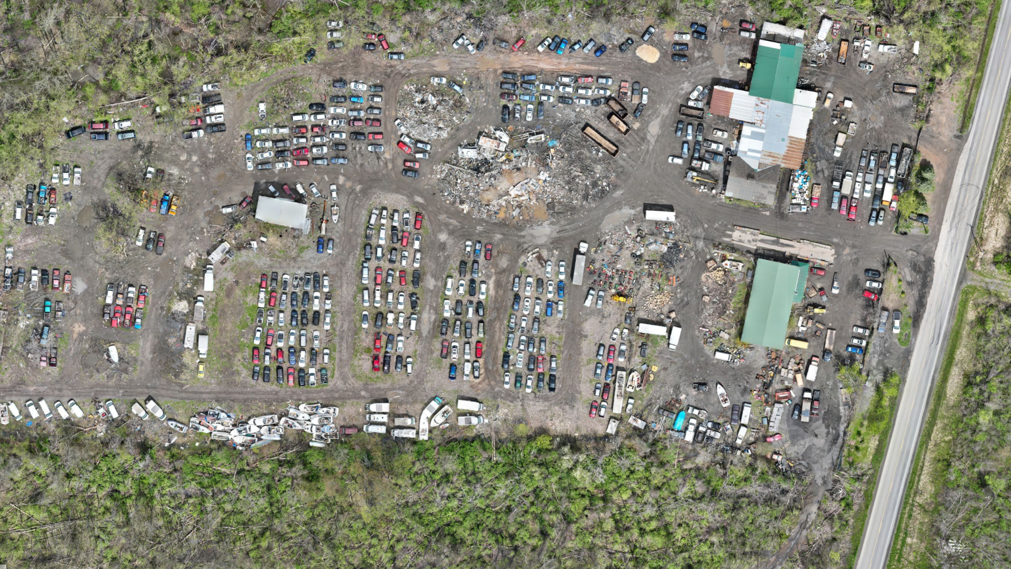
Manual inspections are time-consuming, disruptive, and sometimes risky. Our drone services deliver fast, detailed aerial documentation that saves time, reduces costs, and eliminates access challenges. We capture high-resolution imagery, videos, and data across entire job sites or building exteriors in days, not weeks.
At Future Reality Services, we specialize in construction-grade drone documentation that supports progress tracking, inspection, and site planning. Whether you’re monitoring a build, assessing a structure, or documenting assets for compliance, our UAV services help you move faster and make better decisions without sending crews to the roof.
Whether you’re managing a complex job site or need ongoing documentation across multiple properties, we help you scale site visibility without added internal overhead.
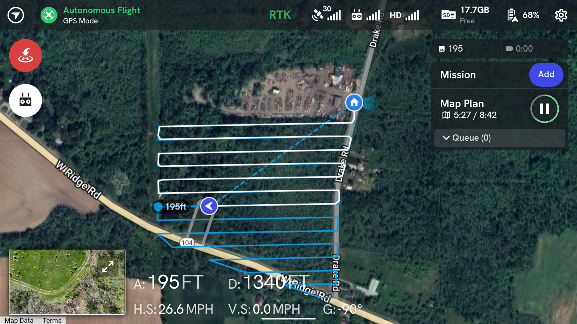
We’ll evaluate your site goals, recommend the right capture approach, and deliver a tailored flight plan to ensure coverage where it matters. No climbing, no guesswork. Just clear visual data.
Our drone crews work efficiently and safely to document your site with no need for ladders, lifts, or shutdowns. Whether it’s a one-time flight or ongoing monthly monitoring, we minimize impact while maximizing visibility.
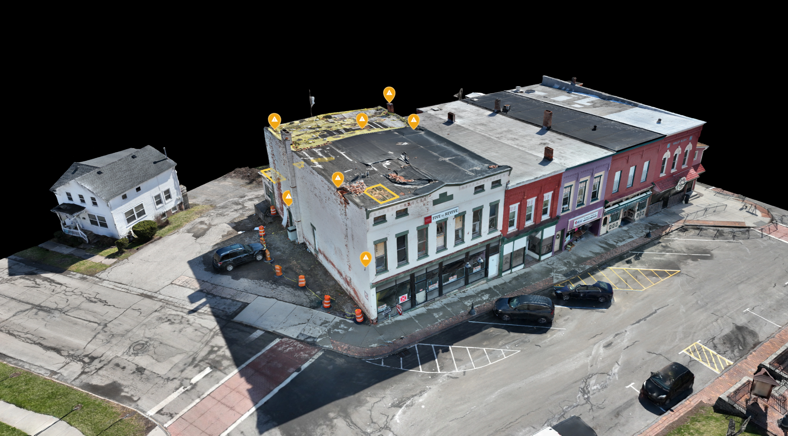
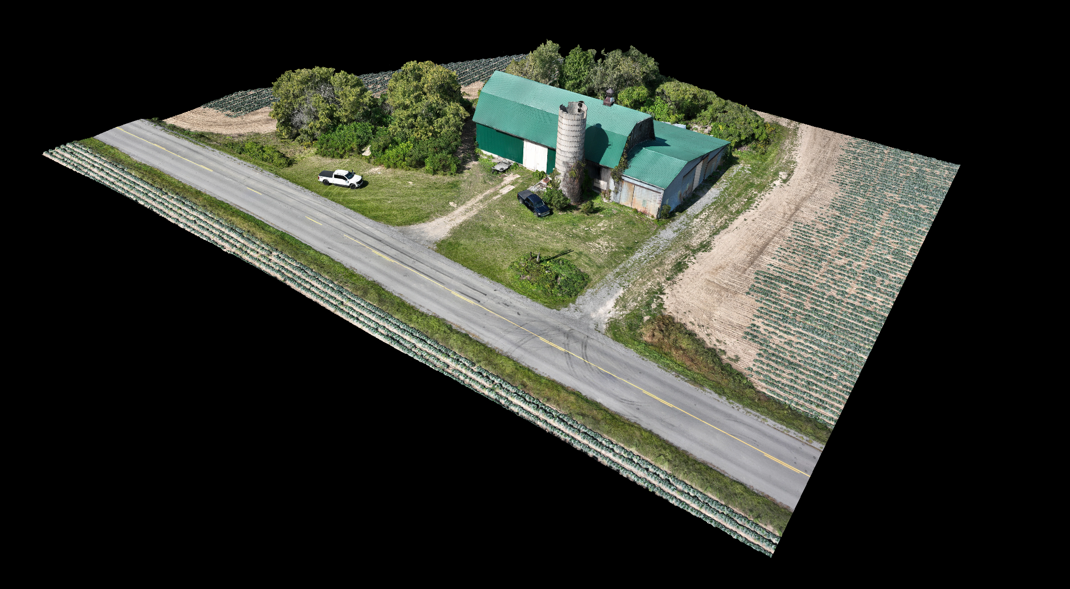
We deliver exactly what your team needs: geotagged aerial photos, 3D terrain models, orthomosaics, or annotated inspection reports. Every file is formatted for use in your existing workflow or tools.
Need updated visuals throughout a long-term build? We offer recurring flights, flexible scheduling, and fast file turnaround to keep your team informed every step of the way.
585-404-4211
We know real-world projects come with real questions. Here are the answers to the ones we hear most often.
Drones support AEC projects by capturing aerial imagery, creating 2D/3D site maps, monitoring construction progress, inspecting hard-to-reach areas, and providing data for BIM integration. They improve visibility, safety, and speed across project phases from planning to closeout.
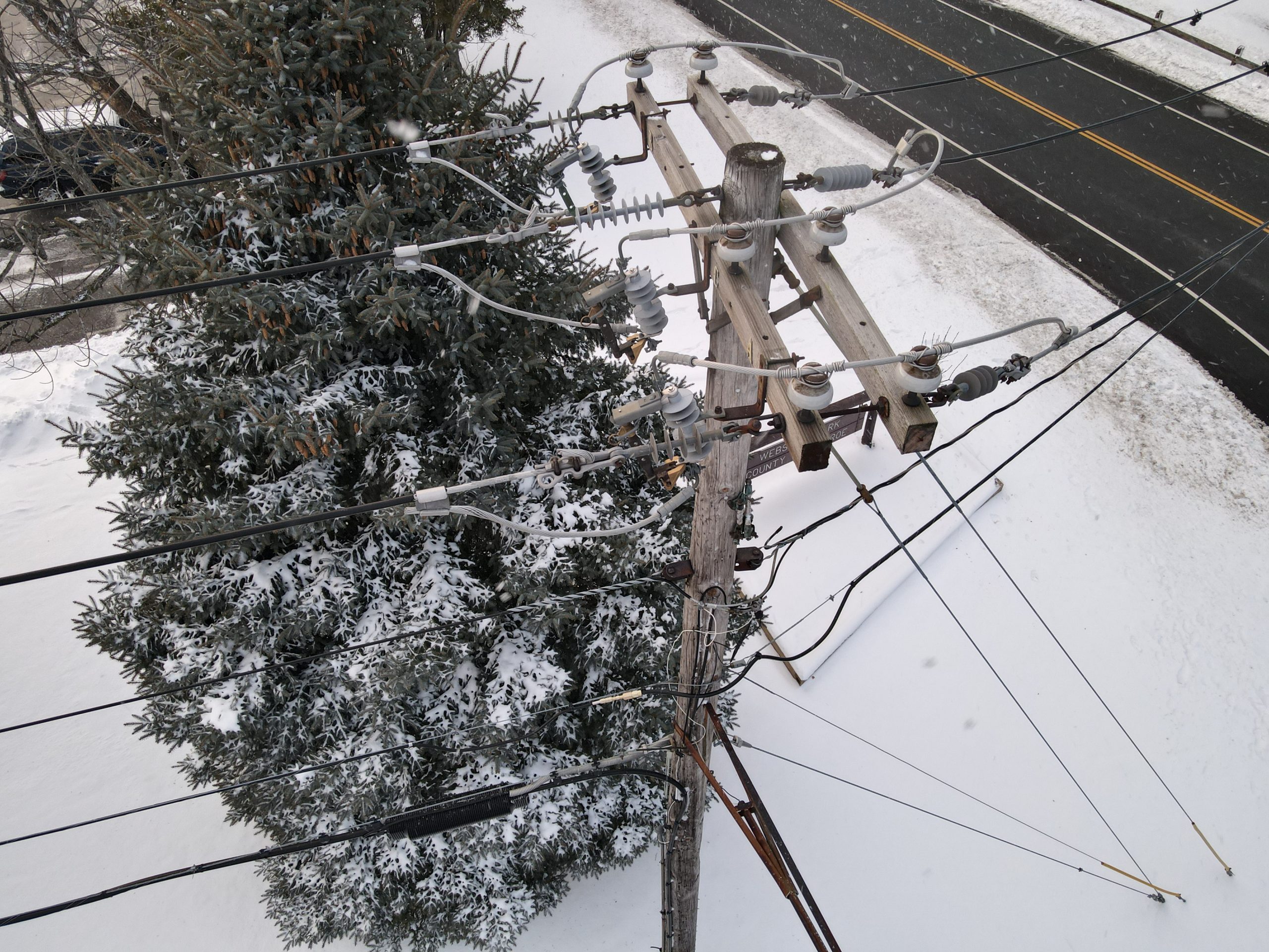
Drones reduce the need for ladders, scaffolding, and risky manual inspections & documentation. They allow teams to safely capture visuals of roofs, facades, towers, and other elevated or dangerous areas without exposing personnel to hazards.
We can generate high-resolution orthomosaic images, 2D site maps, 3D photogrammetry models, point clouds, video walkthroughs, and annotated reports. These deliverables are tailored for planning, progress tracking, inspection, and integration into CAD/BIM workflows.
While drones are primarily used outdoors, indoor flights are possible in some open areas with stable lighting. For tight interior spaces, we typically recommend ground-based scanning or mobile documentation instead.
Modern drones equipped with high-resolution cameras and Real-time kinematic positioning (RTK) modules can deliver centimeter-level accuracy. When combined with ground control points and proper post-processing, drone data meets industry standards for planning, inspection, and record documentation.
Increasingly, yes. Many clients, engineers, and permitting agencies now recognize drone data as a reliable source for documentation, reporting, and planning. Our deliverables are formatted to meet professional standards and support formal review processes.
In most cases, no. If your site is in a restricted airspace, we handle all necessary FAA clearances and airspace authorizations. For private job sites, we also coordinate with site managers to ensure safe and compliant operations.
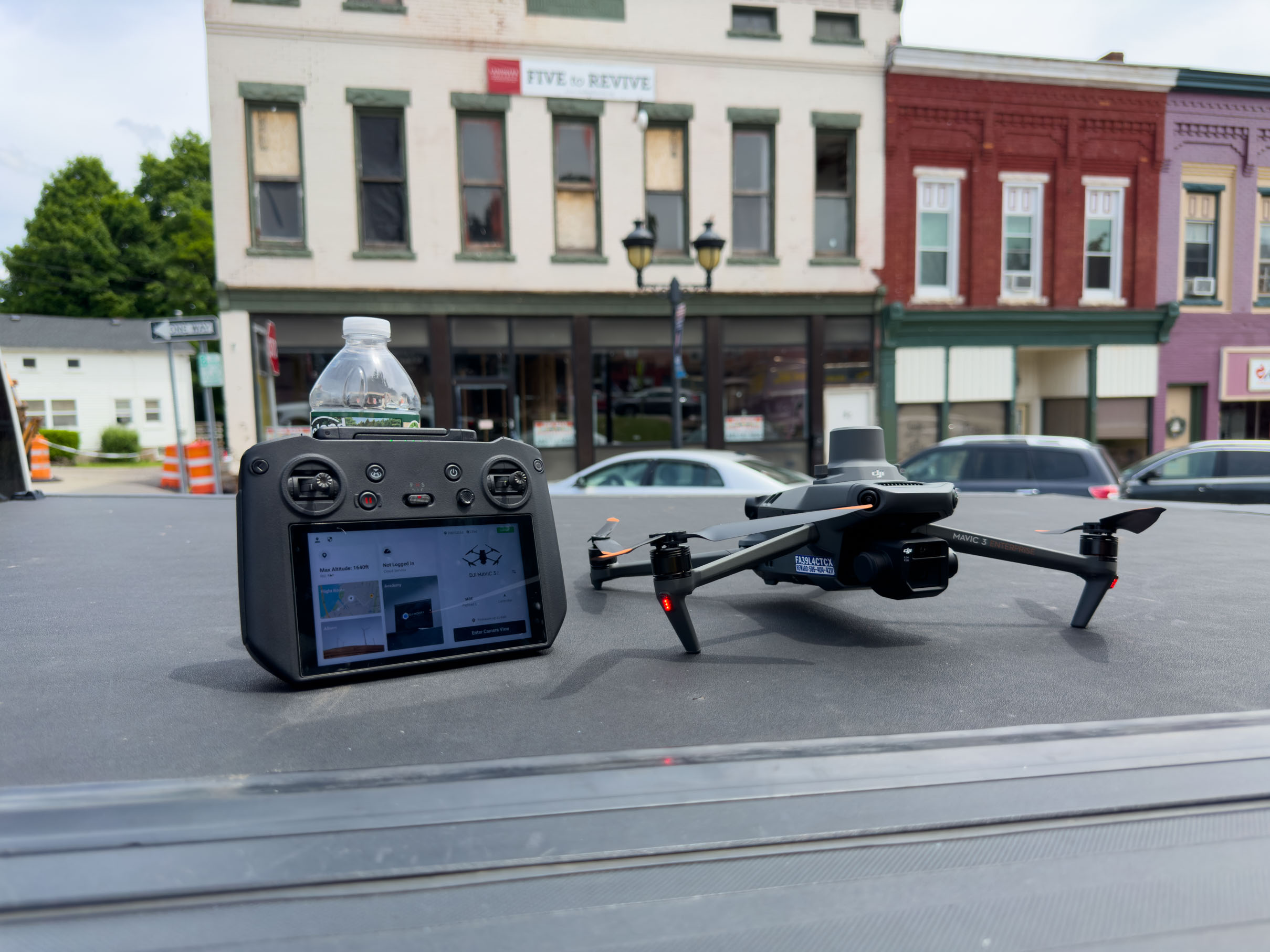
Yes. With precision flight controls and zoom capabilities, we can safely capture detailed imagery of vertical surfaces like curtain walls, cladding, windows, and façades without lifts or scaffolding.