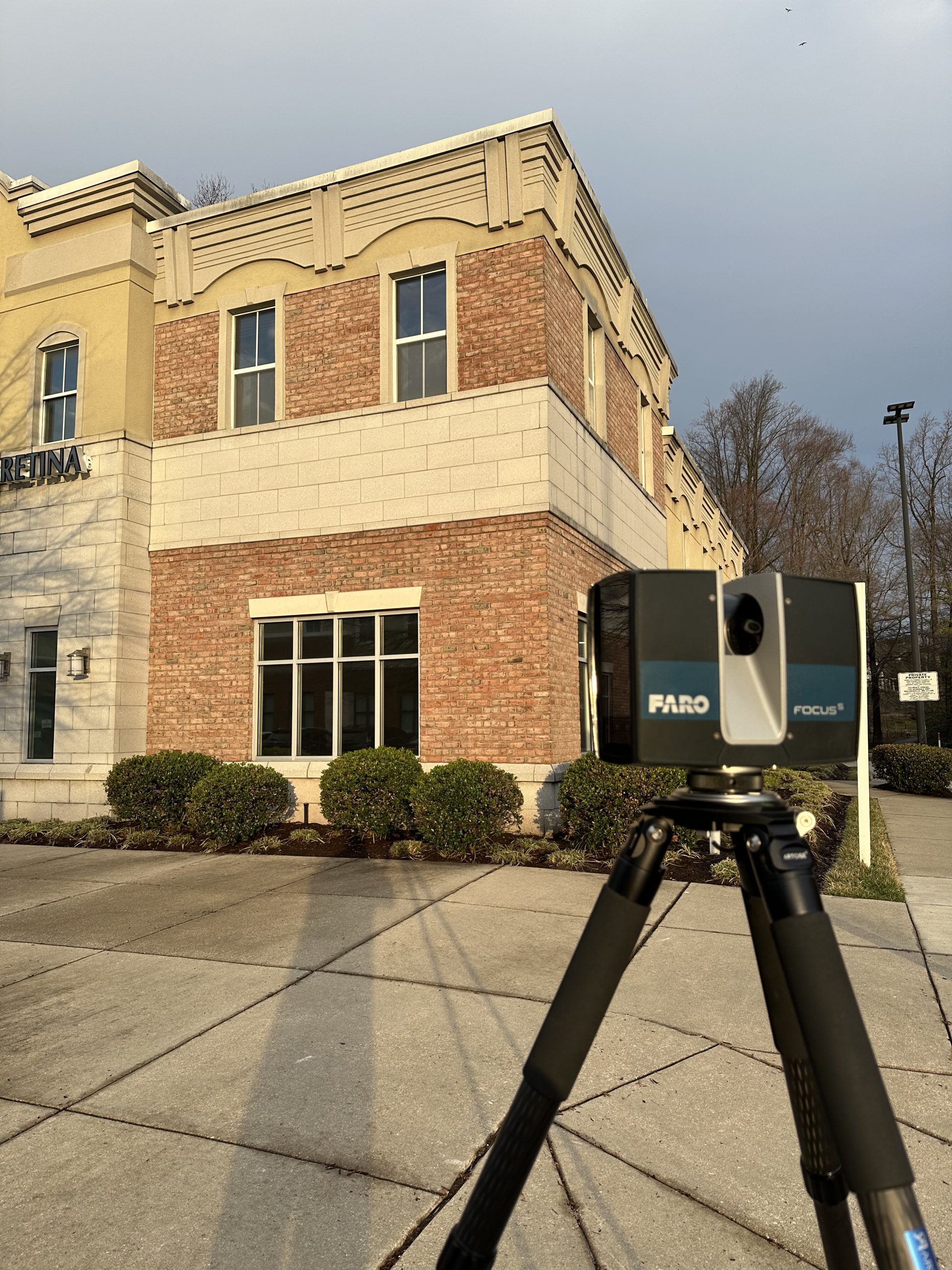
Traditional measuring is slow, error-prone, and labor-intensive. With 3D laser scanning, we capture site conditions in minutes, not days, delivering precise, millimeter-accurate data that manual methods simply can’t match.
At Future Reality Services, we specialize in fast, high-resolution laser scanning for construction, renovation, and engineering projects so your team can make decisions based on facts, not field sketches.
Whether you’re documenting an existing structure, planning a complex retrofit, or coordinating multiple trades, our scans eliminate rework and accelerate your workflow from day one.
We’ll evaluate your project needs, recommend a tailored scan approach, and deliver a clear scope of work. No guesswork, just actionable clarity.
We follow strict field protocols to ensure fast and non-invasive data collection, even while sites remain active. Safety and coordination with your team are always a priority.
We provide a variety of final deliverables to match your needs. Every deliverable is organized, verified, and formatted to fit your workflow.
Need updated floor plans, revised models, or different file formats as the project evolves? Our team is available for ongoing support when you need it.
585-404-4211
We know real-world projects come with real questions. Here are the answers to the ones we hear most often.
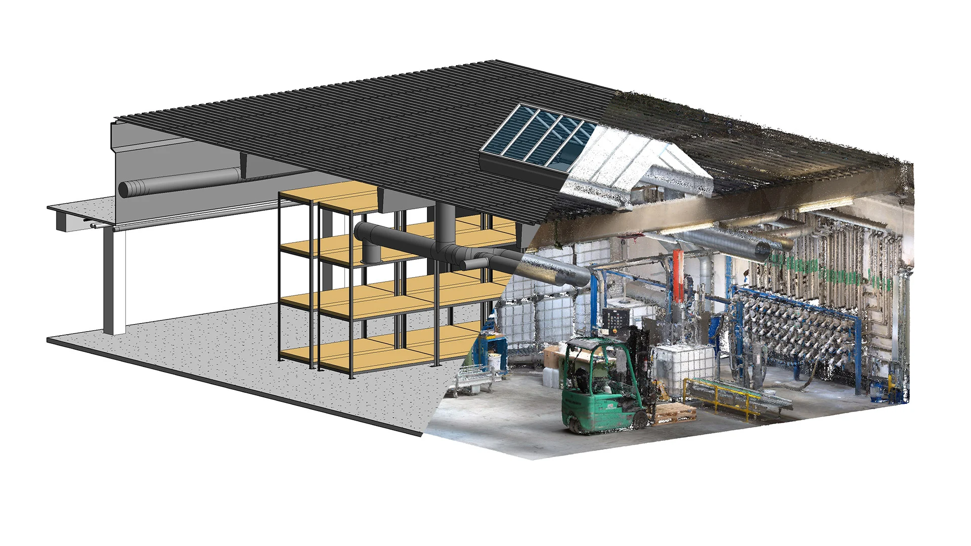
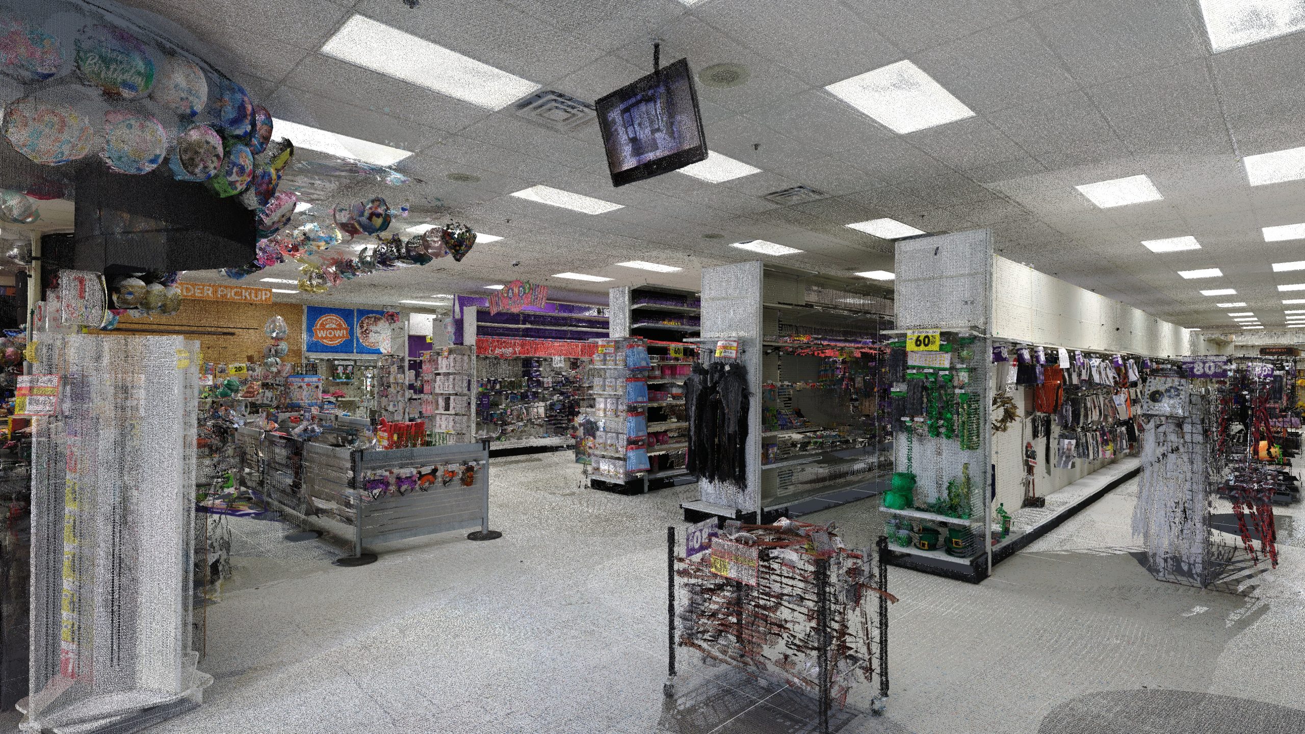
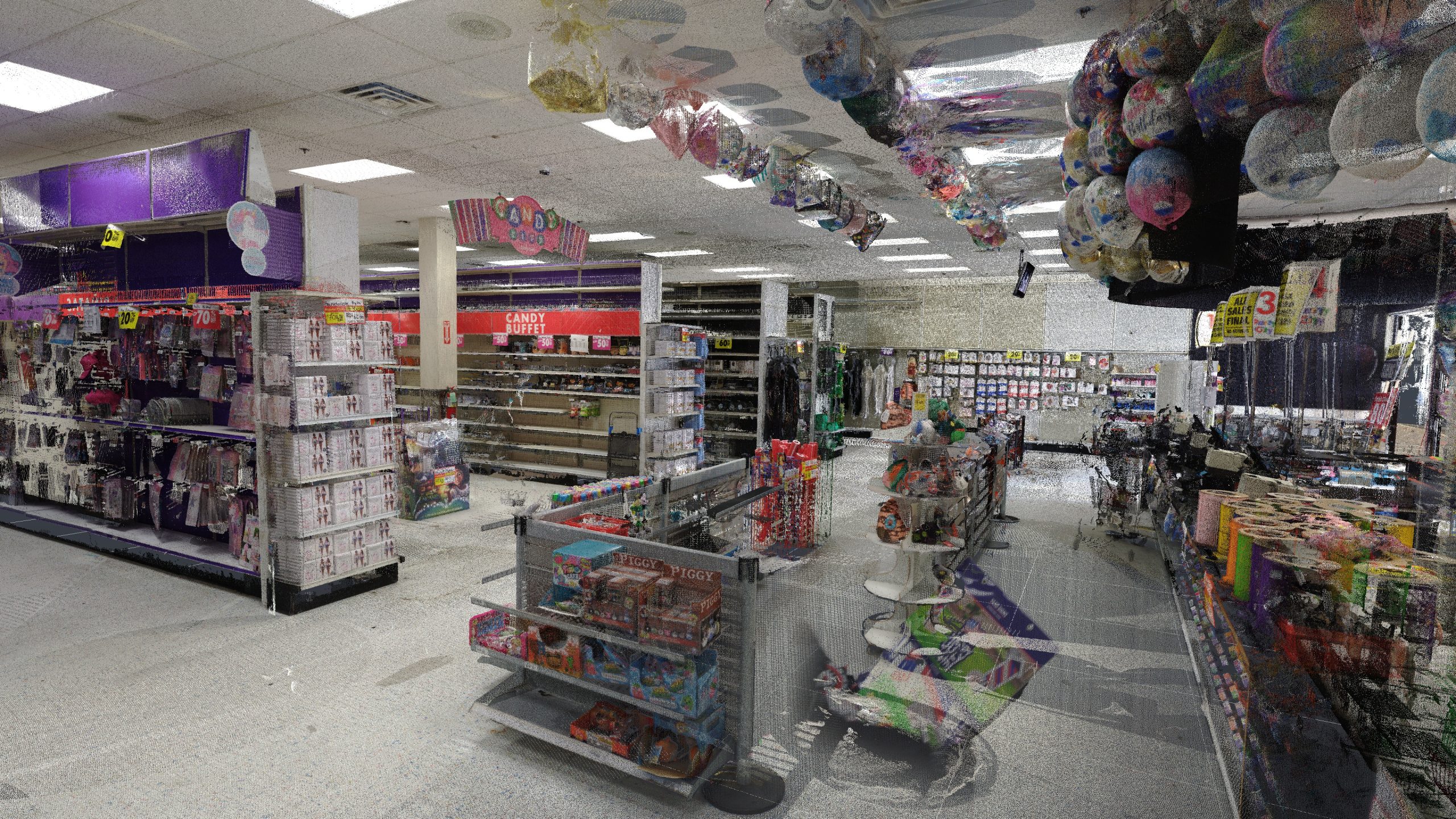
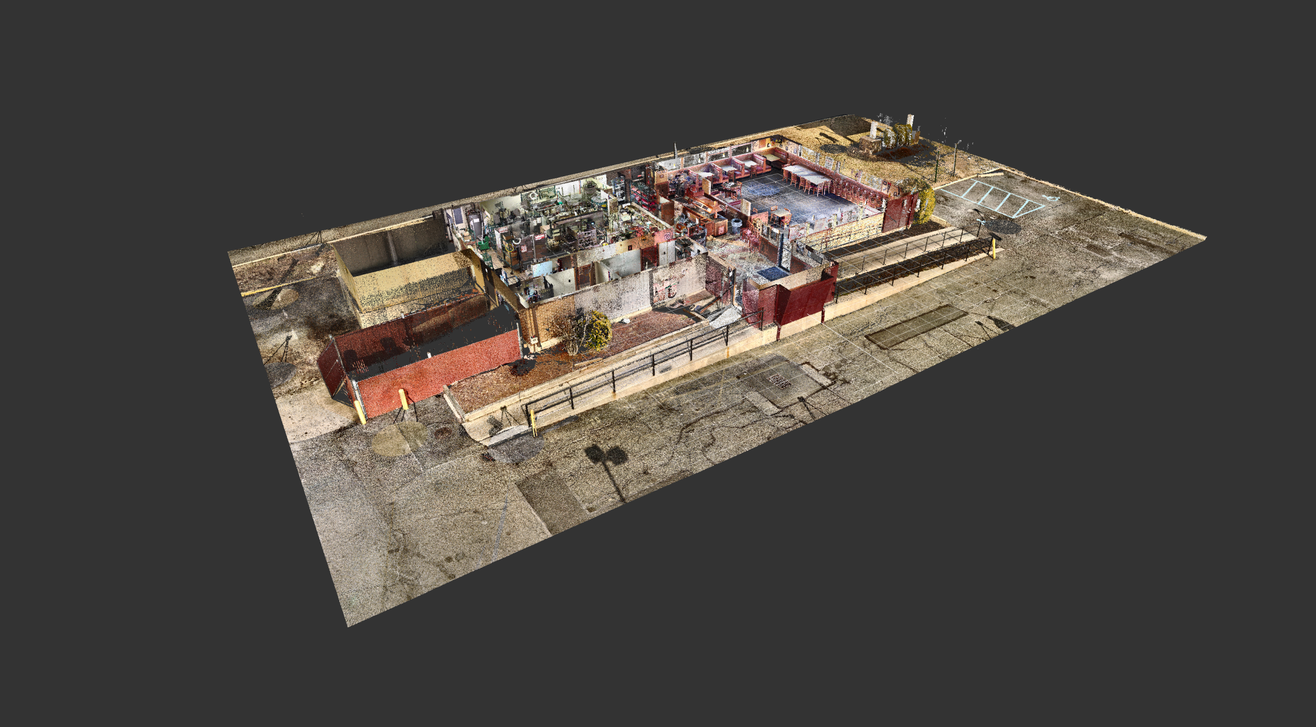
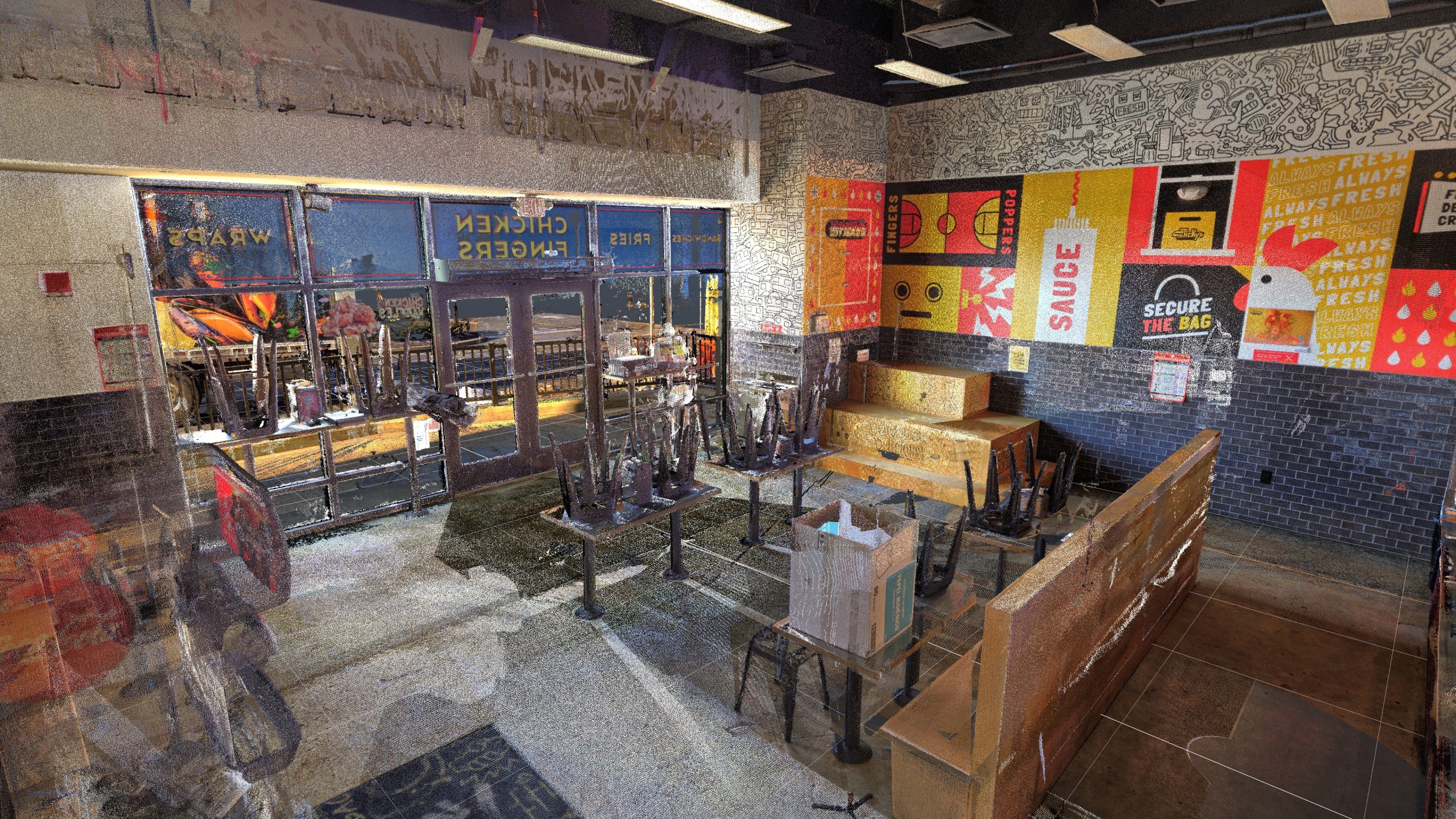
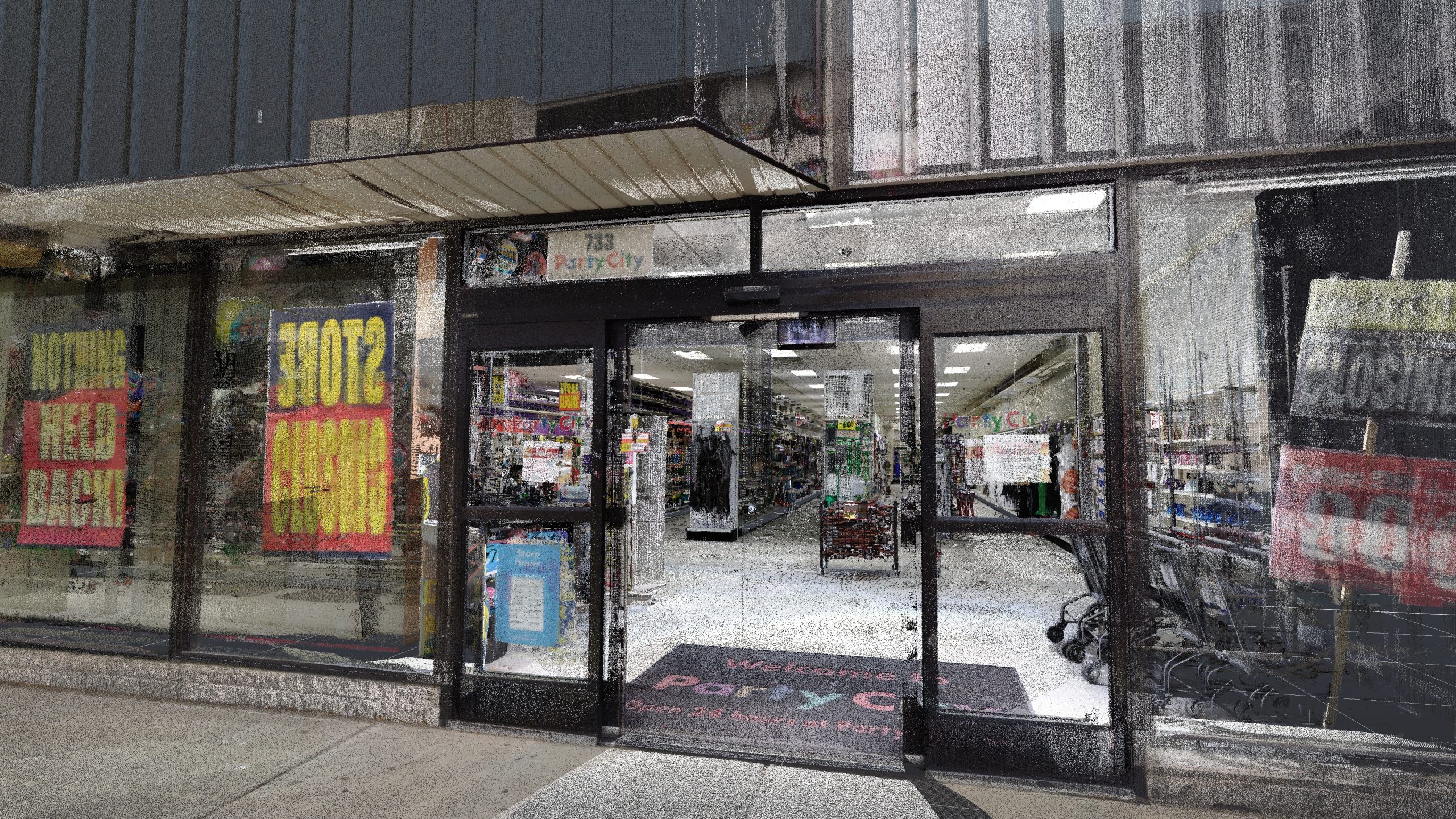
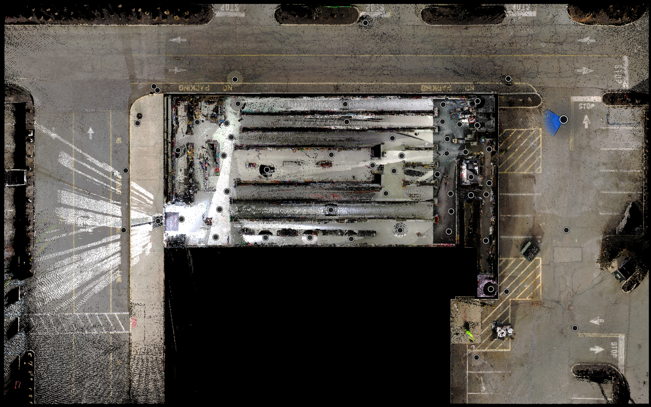
3D laser scanning is a non-contact method of capturing spatial data using LiDAR sensors. It produces a high-density point cloud of a space or structure, which can be used to generate accurate floor plans, elevations, sections, and 3D models. It’s widely used in construction, architecture, engineering, and facility management for its precision and speed compared to traditional methods.
Laser scanning is ideal for:
Renovations or retrofits of existing buildings
Construction progress documentation
As-built verification for BIM
Facilities or asset documentation
Pre-purchase due diligence and site planning
Yes! Our workflows are designed for minimal disruption. Scanning is non-invasive and silent, allowing us to work around live operations, trades, or occupants.
Pricing varies based on project size, level of detail, and deliverables. Basic scanning and point cloud generation can start around $1,250. Full as-builts and BIM packages are quoted per scope. We offer fast estimates after a short discovery conversation.
Laser scanning is significantly more accurate and consistent. While manual methods rely on human measurement and can introduce errors, our scanners capture 1 million+ measurements per second with an accuracy of 1/8 inch or better. This minimizes rework, reduces coordination errors, and provides a trustworthy record of existing conditions.
Many projects can be scanned in one day or less, depending on size and site complexity. A small warehouse building may take only a few hours of field time but a complex manufacturing facility could take a few days. Processing and basic deliverables usually follow within 48 hours. We’ll always give you a clear timeline before starting.
Completely. The laser is invisible to the naked eye, eye-safe (Class 1), and poses no risk to people or electronics. Our team follows strict site safety protocols and coordinates with field crews as needed.
A point cloud is a raw set of millions of spatial points captured during laser scanning. It visually represents the scanned space with high accuracy but isn’t directly editable for design or construction. A 3D model, such as a Revit or CAD file, is a structured, editable representation created from the point cloud and tailored for use in design, coordination, and documentation workflows.
TLDR: A point cloud is millions of points in 3D space measured by the scanner. A 3D Model is an editable digital asset created in the software your team prefers.